
Background
Mercator was born Gerhard Kremer in Rupelmonde, Flanders, on March 5, 1512; the son of Hubert (de) Kremer and his wife Emerance.

(Some time around 1572 Gerardus Mercator, the most famous ...)
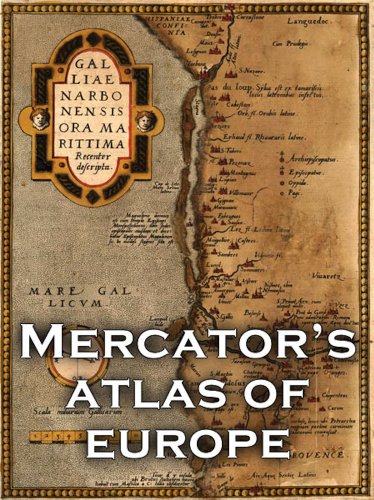
Some time around 1572 Gerardus Mercator, the most famous map-maker of all time, compiled this first Atlas of Europe from copies of wall maps, cut and pasted to form a handy, portable atlas. It was made for the European grand tour of the crown prince of Cleves. After the journey the atlas can be traced to a German monastery, but it disappeared in 1797 for almost 200 years. Then, in 1967 it was bought in a Belgian second-hand bookshop by an anonymous buyer, unaware of the ragged atlass amazing history. Twenty years later it passed into the collection of the British Library. The atlas, as well as being a remarkable survivor and a snapshot of a vanished world, is a volume of great beauty. Maps of Europe by both Mercator and Abraham Ortelius sit alongside exquisitely detailed city plans like that of Ancona. The eBookTreasures facsimile edition allows you to magnify the tiniest details and fully appreciate why Gerardus Mercator was the greatest map-maker of his, or any other age. It is also enhanced with text on all openings.
http://www.amazon.com/gp/product/B00DOAG99E/?tag=2022091-20
(Gerardus Mercator can confidently be called the greatest ...)
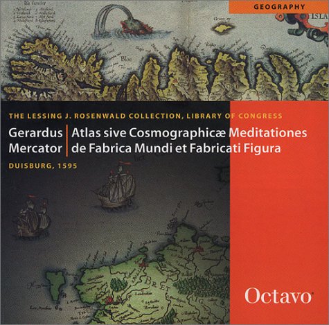
Gerardus Mercator can confidently be called the greatest cartographer of the sixteenth century. His most famous contribution to science is a technique of rendering the globe on a flat surface, still known as "Mercators projection," that was first used for a 1569 world map. No less significant was the publication in 1595, one year after the authors death, of the complete Atlas sive Cosmographicae meditationes de fabrica mundi et fabricati figura (Atlas, or Cosmographic Meditations on the Fabric of the World and the Figure of the Fabrickd). With this volume, a collection of maps was linked for the first time with the figure of Atlas, the Greek Titan, condemned by Zeus to carry the vault of heaven on his shoulders. For Mercator, geographical description was more than the practical matter of locating places or showing how to get from one point to another. The cartographer was able to split the world in unfamiliar and uncomfortable ways, but he also had the means, through mathematical reasoning, to bind it up so that it approached a divine unity. Although the idea of bringing maps together into a book did not originate with Mercator, he can certainly be called the first modern, scientific cartographer. His early charts, used with a magnetic compass (and an awareness of compass declination) gave the sailor the most reliable guide he had ever possessed. No one else could claim the breadth of his understanding of terrestrial magnetism and map projection. Mercator also published the first manual of the italic hand to be printed outside Italy; he used italic exclusively on his maps and it, too, has remained a staple of cartography up to the present day. This particular copy of Mercators Atlas is exceptional for its beautiful hand-coloring. Commentary by Robert W. Karrow, Jr., essay on color in cartography, English translation.
http://www.amazon.com/gp/product/1891788264/?tag=2022091-20
Mercator was born Gerhard Kremer in Rupelmonde, Flanders, on March 5, 1512; the son of Hubert (de) Kremer and his wife Emerance.
He studied with the cosmographer Gemma Phyrisius at the University of Louvain and gained practical experience as an instrument maker and surveyor.
His early successes brought him into close contact with the court of Emperor Charles V; but under growing pressure for his Protestant beliefs, he emigrated to the German Rhineland in 1552. There he settled permanently with his workshop in Duisburg, and in 1564 he became cosmographer to the court of the Duke of Jülich, Cleve, and Berg. Mercator's early works prepared the way for his world map of 1569. These included maps of the Holy Land (1537), the world (1538), Flanders (1540), Europe (1554; rev. ed. 1572), and Britain (1564). He also constructed terrestrial and celestial globes (1541 and 1551). These maps reflected the critical compilation and rendition of a growing body of data that were typical of the cartographical methods of the time. The 1554 map of Europe showed Mercator's willingness to abandon the theories of Ptolemy and other predecessors in the light of further advances in knowledge. The length of the Mediterranean was shortened by 10 degrees (though remaining disproportionately long), and the stretch of land between the Baltic and the Black seas was widened. Others may have experimented with the "Mercator projection" before Mercator; he was the first, however, to give cartographical rendition to the solution to the problem for which the projection was designed. This was the problem of plotting loxodromes (rhumb lines, or lines of constant bearing) as straight lines on a navigator's chart. Meridians of longitude converge at the poles, but if lines of constant bearing are plotted as cutting across them at constant angles, they must appear as parallel on the flat map, or chart. This requirement in turn necessitates a proportional increase in parallels of latitude from the Equator to the poles (proportional to the increasing east-west distances between the meridians). The shape of sectional areas is preserved, and the loxodromes can now be plotted as straight lines, although this is achieved at the expense of distortion of the world map as a whole (that is, the radical increase in relative proportions from Equator to poles, hence the apparent gigantism of land masses like Australia and Greenland on a Mercator projection map). This was the solution rendered in the 1569 world map, but it was not fully accepted by navigators until small area charts based on the projection began to be published in the next century. The rest of Mercator's life was taken up with a three-part publishing project. He planned to print maps based on Ptolemy's Geography, maps of the ancient world, and an atlas of modern maps. The Ptolemaic maps were published in 1578, and the modern atlas appeared in three sections between 1585 and 1595. The entire work (mainly maps of western and southern Europe), totaling 107 maps, was published in 1595. Mercator, however, had died the year before at Duisburg, on December 2, 1594.
Gerhardus Mercator is best known for his great world map, or chart, using the projection that has acquired his name. In the history of cartography the work of Gerhardus Mercator illustrated a significant departure (though by no means a complete break) with the geographical traditions of the Middle Ages and those established by the revived Ptolemaic geography. It also signaled the late Renaissance convergence of academic cartography with the practical needs of navigators, an important step in the creation of that dynamic unity between science and technology that is one of the signal characteristics of the modern world.
(Some time around 1572 Gerardus Mercator, the most famous ...)
(Gerardus Mercator can confidently be called the greatest ...)
Mercator was a devout Christian born into a Catholic family at a time when Martin Luther's Protestantism was gaining ground. He never declared himself as a Lutheran but he was clearly sympathetic and he was accused of heresy (Lutheranye).
His first wife was Barbara, who died in 1586 and his eldest son Arnold died the following year. In 1589, at the age of 77, he took a new wife, Gertrude Vierlings, the wealthy widow of a former mayor of Duisburg.
