

Background
Henricus Germanus was born Heinrich Hammer in Nuremberg, Germany.
https://www.amazon.co.uk/Germanus-Cosmography-Art-Framed-Poster/dp/B07R3DP1RK/?tag=prabook0b-20
1482
Henricus Germanus was born Heinrich Hammer in Nuremberg, Germany.
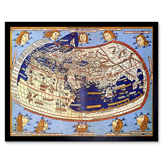
Henricus Martellus is a mysterious personality of whom no mention has ever been found except for the remarkable maps that he signed with his full name. It is established that he worked in Florence in the closing decades of the fifteenth century and was closely associated with the printer, engraver, and map publisher Francesco Rosselli. His works include two sets of maps drawn to illustrate Ptolemy’s Geography, five codices of an Insularium, or Book of Islands, and a large world map (43” by 75”).
Roberto Almagià states that Germanus was the first mapmaker to append to the traditional set of maps illustrating the work of Ptolemy a set of maps showing the world of his time, the “tabulae modernae.” Of these the most important are the world maps added to several of his insularia and the large world map now in the Yale University Library. These maps show the world on the eve of Columbus’ voyages; the continent of Africa as reported by the Portuguese, and open Indian Ocean, a jumbled - but in places recognizable - eastern coast of Asia, and, on the Yale world map, Japan, identified as “Zipango.”
There can be little doubt that Germanus’ world maps served as the model for Martin Behaim’s celebrated 1492 globe, the oldest surviving globe in the Western world. Further, it is highly probable that Germanus’ map, or a copy thereof, inspired the geographic ideas of Columbus. According to Almagià it can best explain the geographic premises of all of Columbus’ voyages and would fully support his convictions, his conjectures, and his projects. The influence if Germanus’ large world map, in all likelihood circulated in printed from throughout Europe, is evident in nearly all of the important maps of the Columbian age.
