
Background
Matthew Henry Edney was born on January 23, 1962, in London, United Kingdom, to Henry F. S. Edney, a contractor, and Sarah (Eaton) Edney.

London, United Kingdom
University of London

Madison, Wisconsin, United States
University of Wisconsin–Madison

Vestal, New York, United States
State University of New York at Binghamton

96 Falmouth St, Portland, ME 04103, United States
University of Southern Maine

314 Forest Ave, Portland, ME 04101, United States
Osher Map Library and Smith Center for Cartographic Education
London, United Kingdom
University of London
Madison, Wisconsin, United States
University of Wisconsin–Madison
Vestal, New York, United States
State University of New York at Binghamton
96 Falmouth St, Portland, ME 04103, United States
University of Southern Maine
314 Forest Ave, Portland, ME 04101, United States
Osher Map Library and Smith Center for Cartographic Education
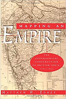
(In this fascinating history of the British surveys of Ind...)
In this fascinating history of the British surveys of India, Matthew H. Edney relates how imperial Britain used modern survey techniques to not only create and define the spatial image of its Empire, but also to legitimate its colonialist activities. "There is much to be praised in this book. It is an excellent history of how India came to be painted red in the nineteenth century. But more importantly, Mapping an Empire sets a new standard for books that examine a fundamental problem in the history of European imperialism."—D. Graham Burnett, Times Literary Supplement "Mapping an Empire is undoubtedly a major contribution to the rapidly growing literature on science and empire, and a work which deserves to stimulate a great deal of fresh thinking and informed research."—David Arnold, Journal of Imperial and Commonwealth History "This case study offers broadly applicable insights into the relationship between ideology, technology and politics. . . . Carefully read, this is a tale of irony about wishful thinking and the limits of knowledge."—Publishers Weekly In this fascinating history of the British surveys of India, Matthew H. Edney relates how imperial Britain used modern survey techniques to not only create and define the spatial image of its Empire, but also to legitimate its colonialist activities. "There is much to be praised in this book. It is an excellent history of how India came to be painted red in the nineteenth century. But more importantly, Mapping an Empire sets a new standard for books that examine a fundamental problem in the history of European imperialism."—D. Graham Burnett, Times Literary Supplement "Mapping an Empire is undoubtedly a major contribution to the rapidly growing literature on science and empire, and a work which deserves to stimulate a great deal of fresh thinking and informed research."—David Arnold, Journal of Imperial and Commonwealth History "This case study offers broadly applicable insights into the relationship between ideology, technology and politics. . . . Carefully read, this is a tale of irony about wishful thinking and the limits of knowledge."—Publishers Weekly
http://www.amazon.com/gp/product/0226184889/?tag=2022091-20
1997
Matthew Henry Edney was born on January 23, 1962, in London, United Kingdom, to Henry F. S. Edney, a contractor, and Sarah (Eaton) Edney.
Edney graduated from the University of London as a Bachelor of Science with first class honors, in 1983. He earned Master of Science degree from the University of Wisconsin-Madison in 1985, as well as doctor's degree in 1990.
Beginning his career, Edney held the position of an assistant professor of geography at the State University of New York at Binghamton, from 1990 to 1995. That year Edney became an associate professor of geography and of American and New England studies at the University of Southern Maine. From 1995, as well, he worked as a faculty scholar at the Osher Map Library and Smith Center for Cartographic Education.
He is a contributor to scholarly journals, including the American Cartographer, the Cartographic Journal, the Imago Mundi and the Journal of Historical Geography. In addition, Edney was a contributing editor to the Cartographica. Edney worked as a member of editorial board of the Historical Geography from 1997.
Edney wrote a carto-bibliography of printed maps of Maine up to the year 1900, he also made an analysis of the development of the state and federal topographic mapping of Maine in context of the state’s economic and industrial development, 1865-1940.
(In this fascinating history of the British surveys of Ind...)
1997
Quotations:
"I am broadly interested in the technological practices, social institutions, and cultural expectations that shape and define the cartographic representation of geographical knowledge. My particular interest is the tension between the modern ideology of maps as scientific, objective documents and the actual practices of knowledge construction. I see myself as a poststructuralist, although I try to steer a middle course between discourse and social practice. In this I find myself most influenced by the work of J. B. Harley and Michel Foucault."
"My work on the British mapping of India really began when I encountered, in the British Library, a Wonderfully aggrieved and fulminating pamphlet by George Everest (after whom the mountain was named) ‘remonstrating against the conduct’ of the Royal Society. This soon led to a realization that there was a huge gulf between how the British surveyed India and how they thought they were surveying India. As I pursued that issue, I inevitably got sucked into the bigger issues of British India and Orientalism. The result is Mapping an Empire."
